There was once a railway line that ran from from Bearley to Alcester. The line opened in 1876 and connected Alcester into the Great Western Railway network. Trains ran from Bearley, winding their way through the Warwickshire countryside through the villages of Aston Cantlow, Great Alne and Kinwarton before ending up at the Alcester.
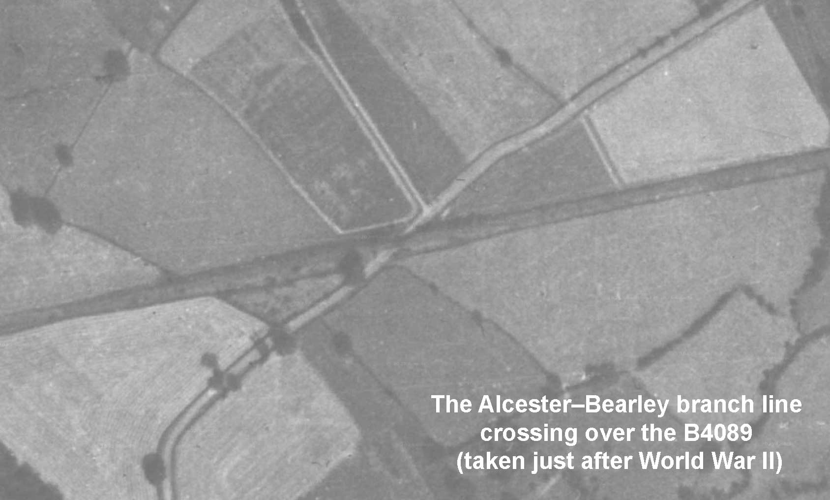
Constructing a railway line provides challenges – the navigation through existing infrastructure – buildings, rivers and in the case of the Alcester Branch public roads. One of the roads in question was the B4089. This road ran connected Alcester to Wooten Wawen and would intersect with the line at Kinwarton, close to the Coughton Fields Lane junction. To overcome this problem an underbridge was built which you can see in the aerial photograph below.

Taken by Richard King in 1960
Fast forward to 1960 and the bridge is still standing despite the line being inactive for almost a decade. The photograph above (taken near the Coughton Fields Lane junction, in the direction of Alcester) reveals that this was a “skewed iron girder” bridge. Notice the red and blue brick pattern, similar to that used on the three-arched bridge over the deep cut over Gerrards Bank.

At this point the line was likely owned by the British Transport Commission as by February 1961 the land from the bridge over Gerrards Bank up to the B4089 was transferred from them to Alcester Estates. A small piece in the Tewkesbury Register & Gazette from the following month confirms the removal of the bridge.

Tewkesbury Register & Gazette. 17/3/61.

Google Maps
It is easy to see the imprint of the line on the landscape some 70 years after it was last used. A lasting reminder of this fascinating piece of local history.
Leave a Reply