A few pictures of Tower Bridge and other key London monuments from the air last Wednesday (5th of March).

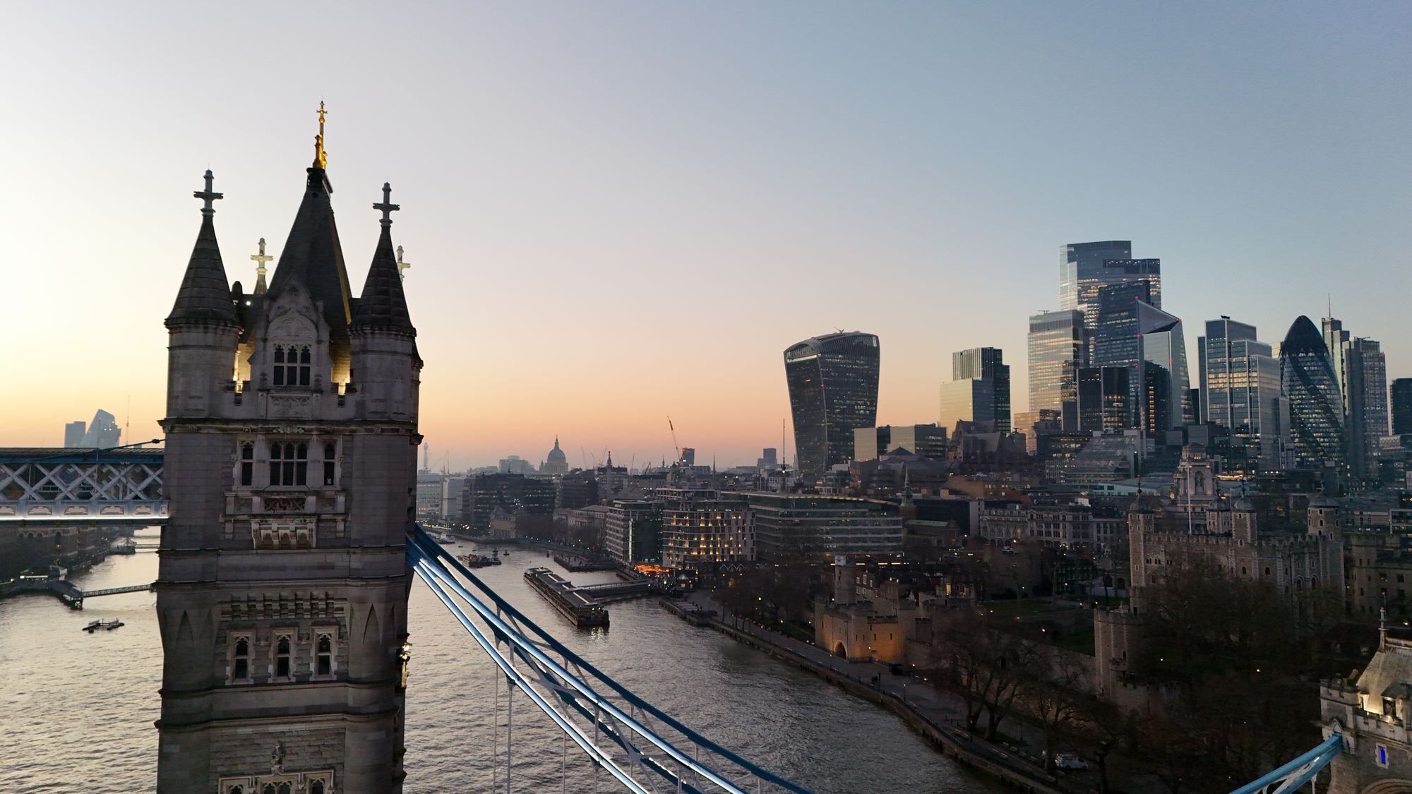

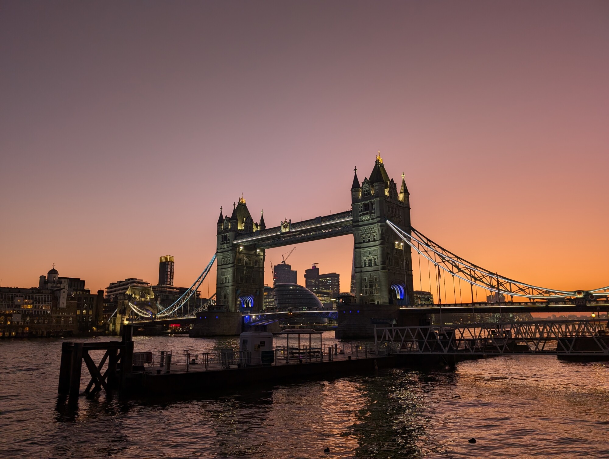

A few pictures of Tower Bridge and other key London monuments from the air last Wednesday (5th of March).
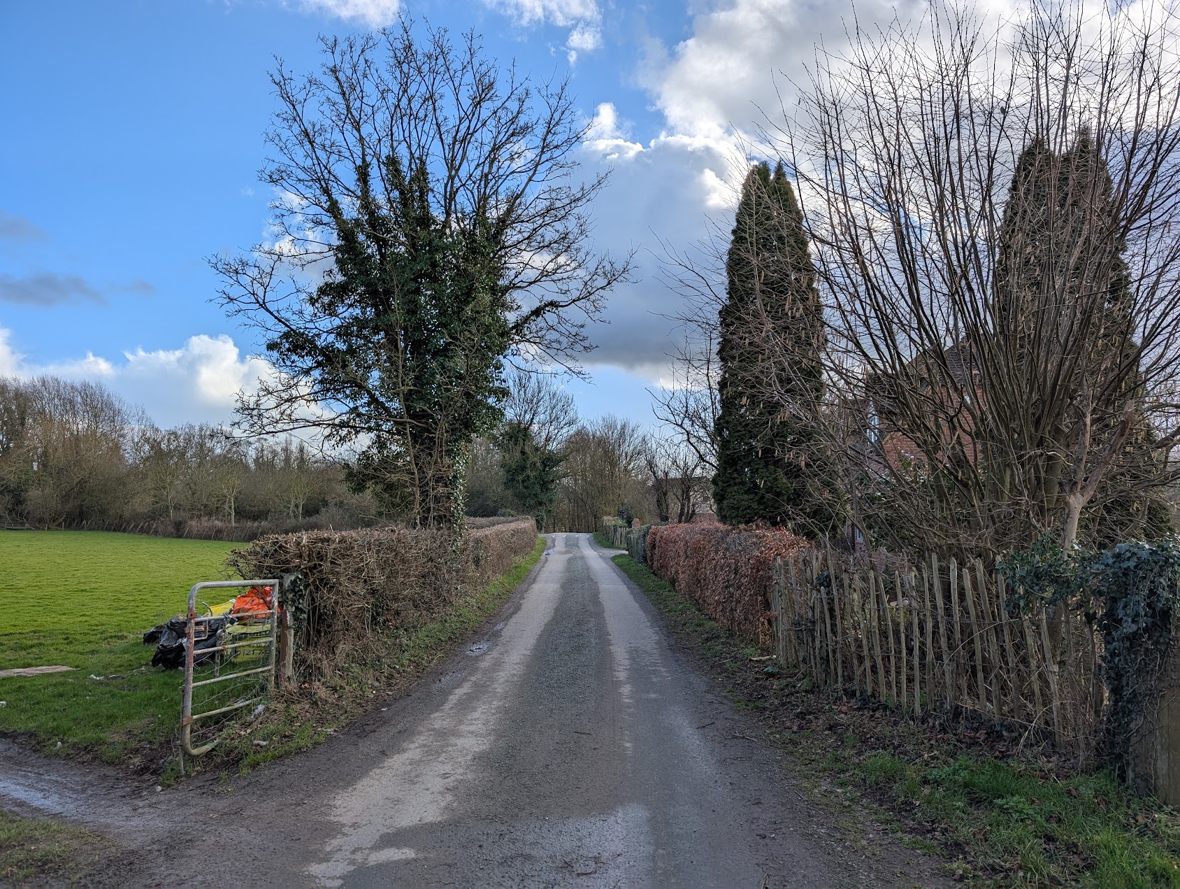
With my recent interest in the Alcester Branch railway I thought it would be good to see more of the line for myself, especially after reading the brilliantly informative book, The Alcester Branch (ISBN: 1905184050). Using maps from the book, I traced the line on recent satellite imagery using public footpaths where possible. And it turns out there is a public route from Kinwarton to Great Alne.
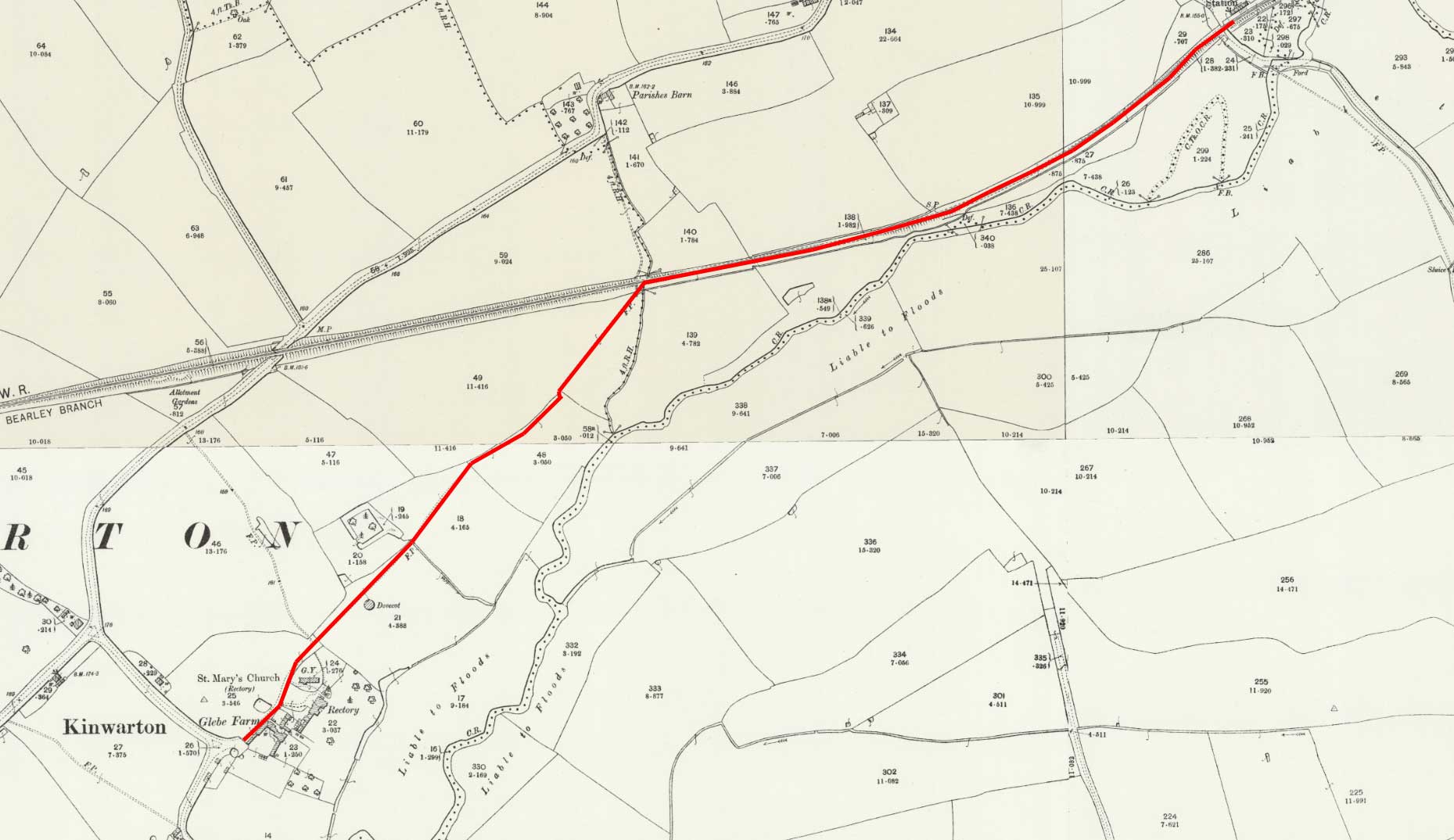
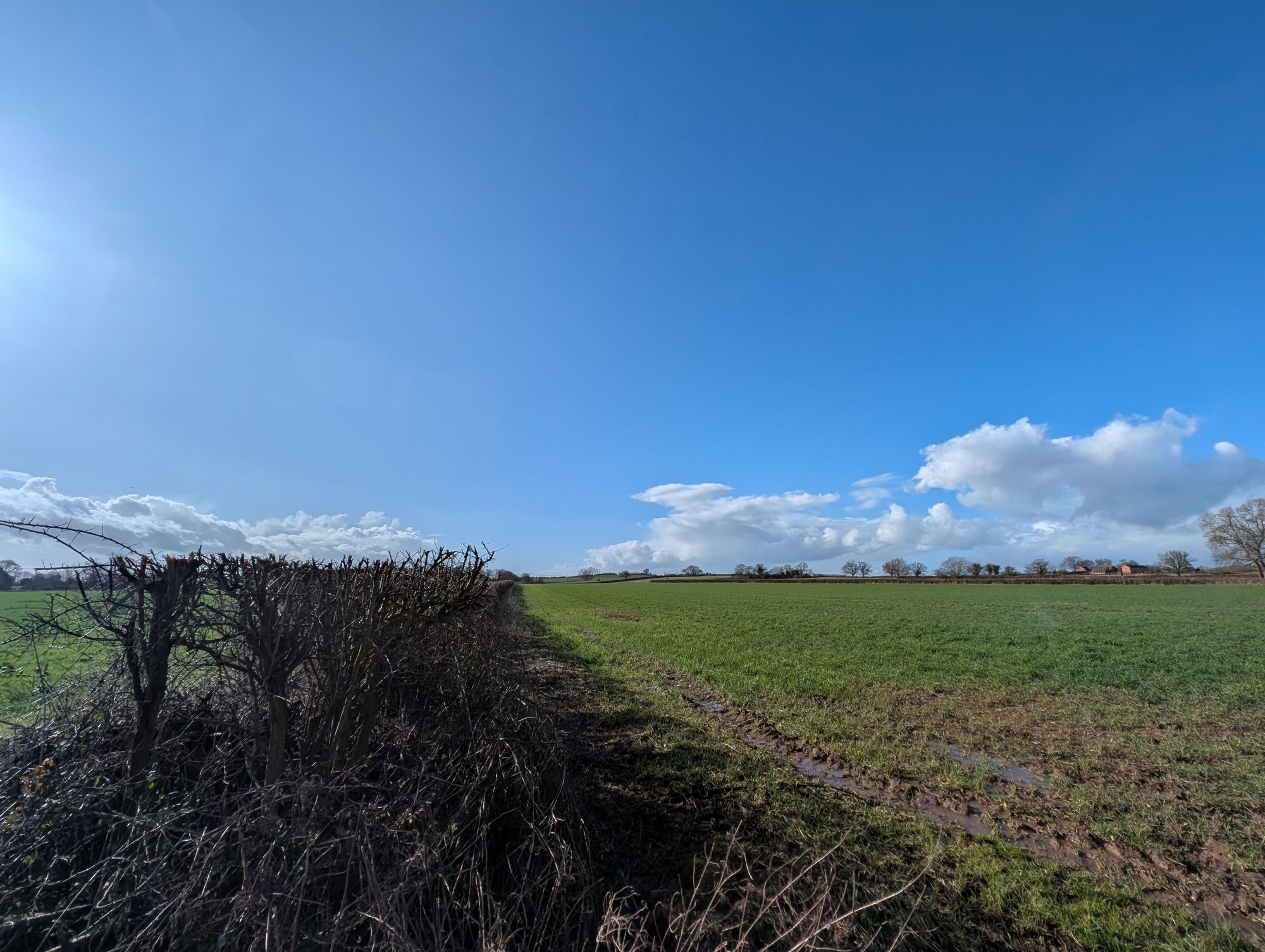
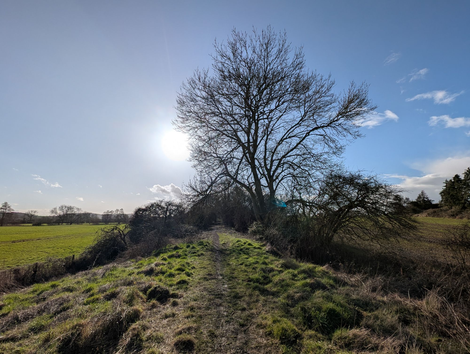
The walk starts at Kinwarton heading north east past the Old Rectory and Church. The path then goes through the Dovecote field and then another field which is divided by a hedgerow. This hedgerow follows the route of the old line towards what is now a walking trail in a woodland nature reserve. This section of the route is on the embankment, built for the rail line and at certain places is only metres away from the Alne river which curves towards the track and out again.
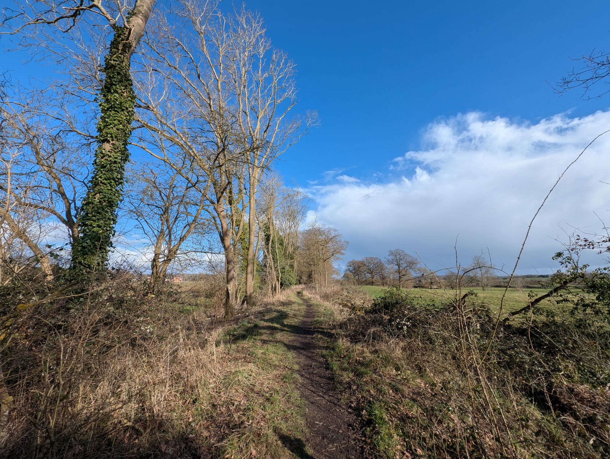
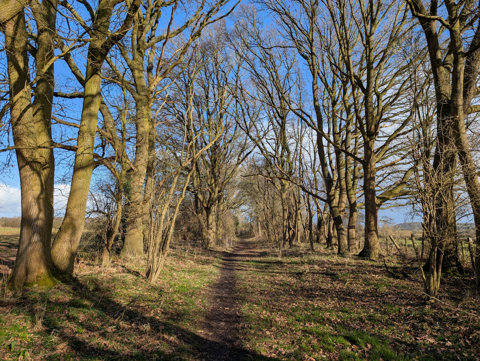
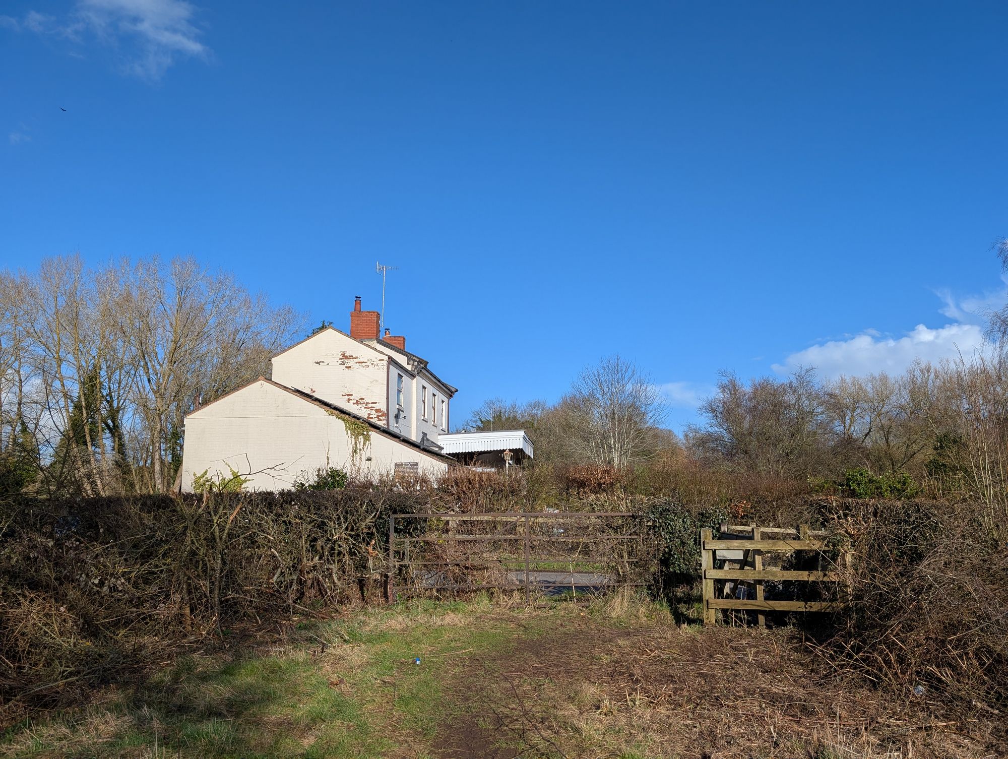
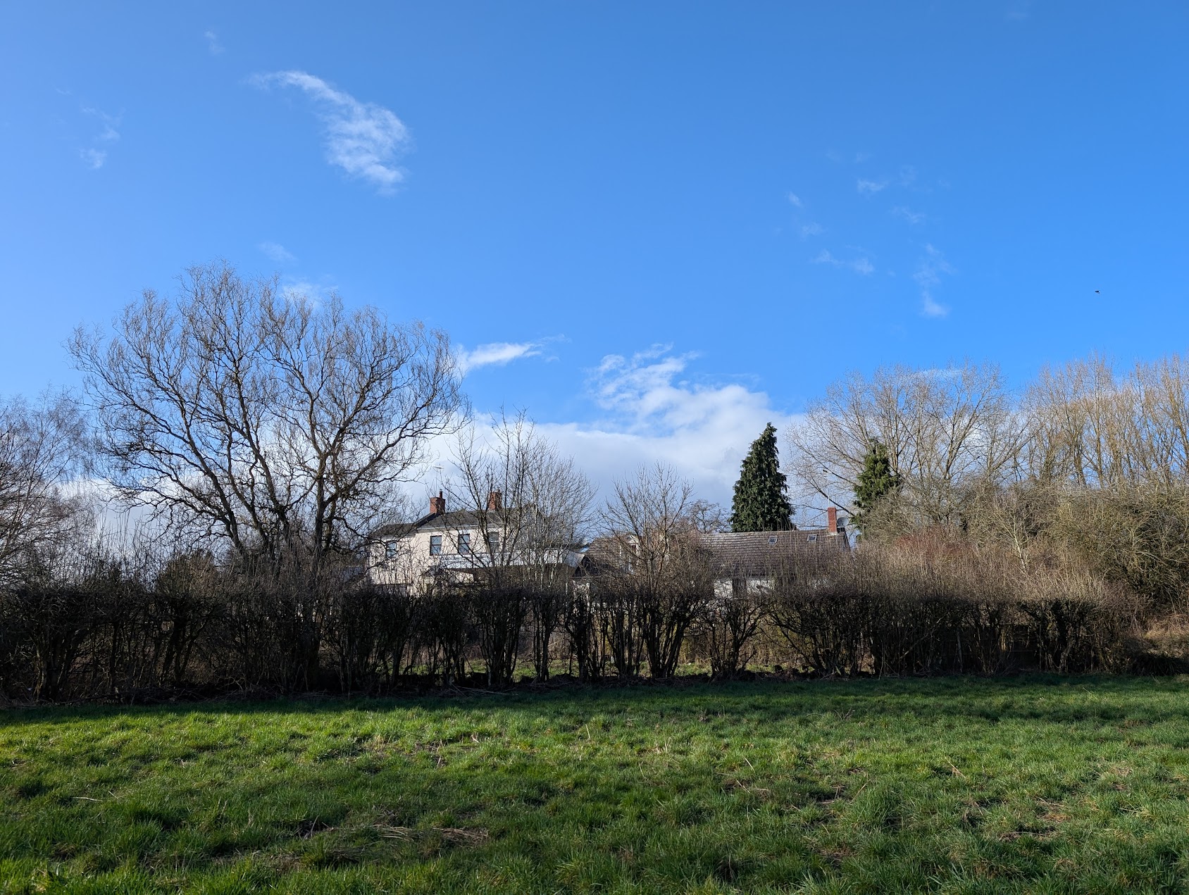
The walking trail continues for about 700 metres before reaching Pelham Lane and what was the old Station house at Great Alne (now a residential house called Station House).
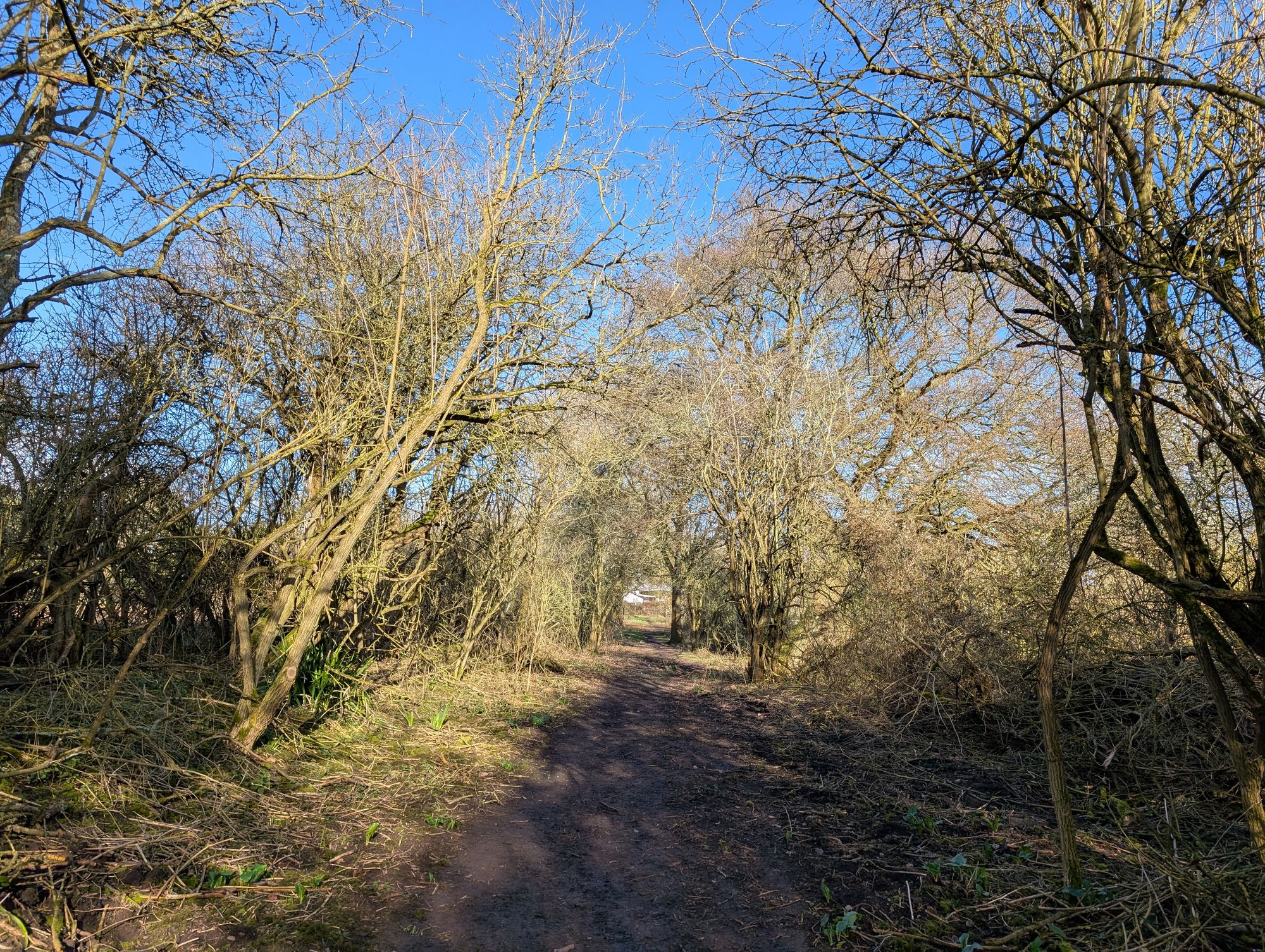
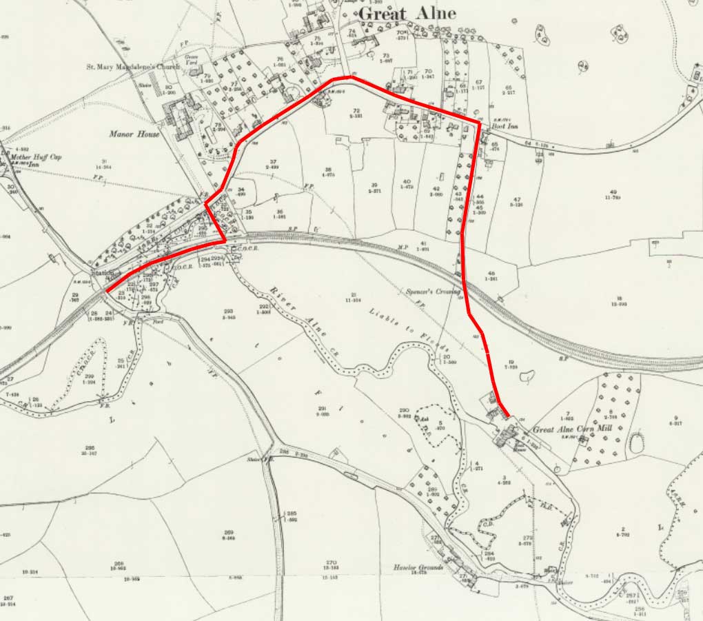
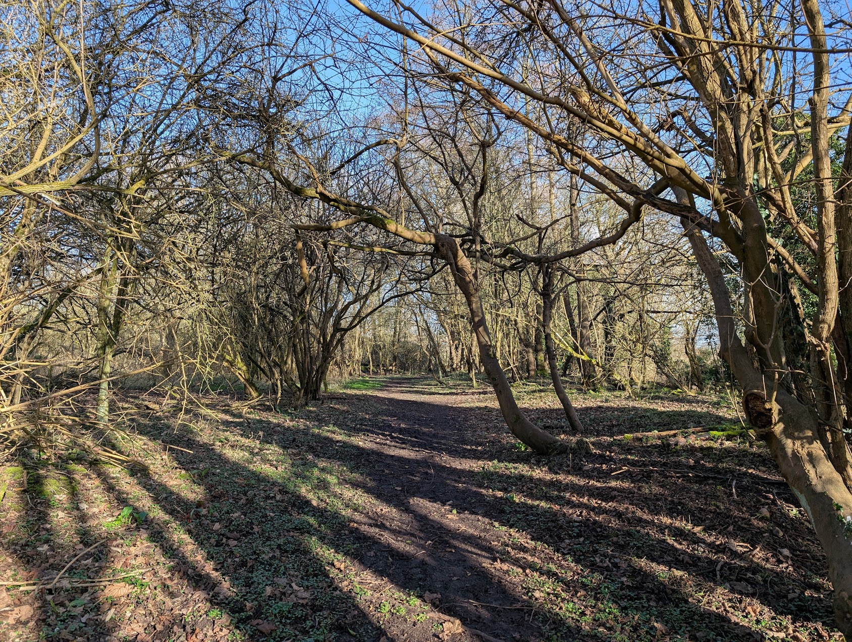
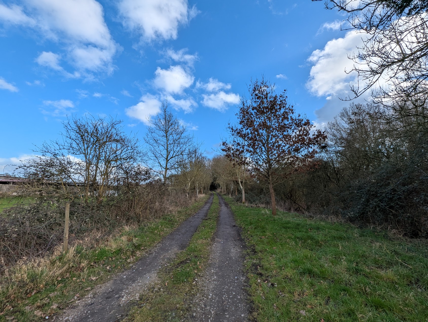
Across the road at Pelham Lane is a woodland conservation area called Coffee Pot Wood. Appropriately named after the nickname for the train that used to roll though here all those years ago. The path takes you through a woodland trail of sorts but only follows the line for a short period before turning off on the Henley Road.
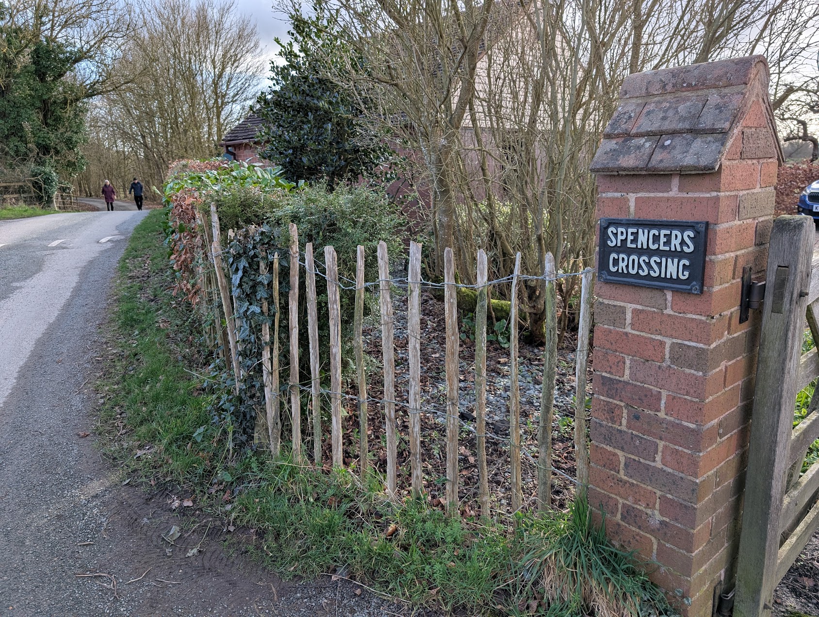
Some parts of this section of the line now run through private farms so I walked on the Henley Road towards Mill Lane.
The contour of the line reveals itself once again at Spencer’s Crossing. It runs through private fields on either side so it’s not possible to walk the line here. Further down Mill Lane is of course the old Mill which no longer operates as a mill. It was once run by the Spencer family which is where the name Spencer comes in for the crossing.
This was a good walk. Though I would mention that the fields at Kinwarton can be quite muddy in the colder months so wearing the right footwear is essential.
Date of walk: 22nd of February 2025
There was once a railway line that ran from from Bearley to Alcester. The line opened in 1876 and connected Alcester into the Great Western Railway network. Trains ran from Bearley, winding their way through the Warwickshire countryside through the villages of Aston Cantlow, Great Alne and Kinwarton before ending up at the Alcester.
Constructing a railway line provides challenges – the navigation through existing infrastructure – buildings, rivers and in the case of the Alcester Branch public roads. One of the roads in question was the B4089. This road ran connected Alcester to Wooten Wawen and would intersect with the line at Kinwarton, close to the Coughton Fields Lane junction. To overcome this problem an underbridge was built which you can see in the aerial photograph below.
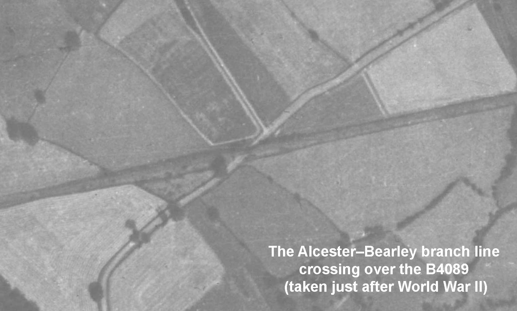

Fast forward to 1960 and the bridge is still standing despite the line being inactive for almost a decade. The photograph above (taken near the Coughton Fields Lane junction, in the direction of Alcester) reveals that this was a “skewed iron girder” bridge. Notice the red and blue brick pattern, similar to that used on the three-arched bridge over the deep cut over Gerrards Bank.

At this point the line was likely owned by the British Transport Commission as by February 1961 the land from the bridge over Gerrards Bank up to the B4089 was transferred from them to Alcester Estates. A small piece in the Tewkesbury Register & Gazette from the following month confirms the removal of the bridge.


It is easy to see the imprint of the line on the landscape some 70 years after it was last used. A lasting reminder of this fascinating piece of local history.
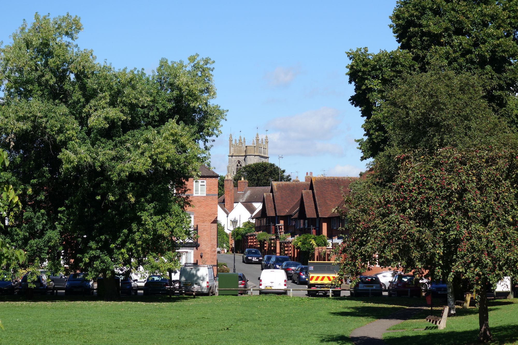
In late summer 2016, I enjoyed a 2.5-mile circular walk from the historic Kinwarton Dovecote, taking a clockwise route towards Alcester.
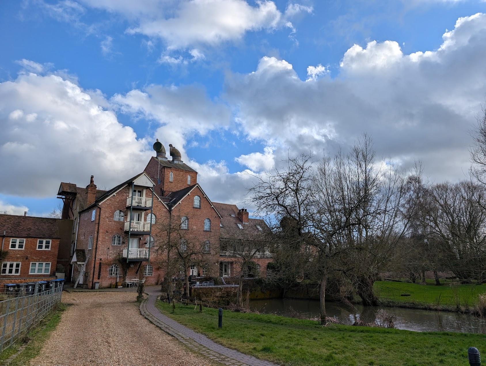
My walk began at the Dovecote, a fascinating example of a medieval dovecote. From there, I headed towards the River Alne, and following it towards the picturesque Hoo Mill. Reaching Hoo Mill, I crossed the footbridge and continued towards the Stratford Road.
As I approached Alcester, the Centenary Field came into view with St Nicholas providing a nice backdrop. Walking through the high street I managed to stop and take a few pictures. One of which you will see on this page – although the scaffolding did ruin it slightly.
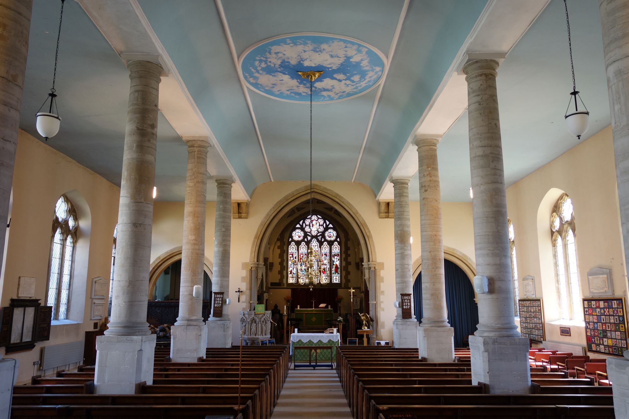
I had never really stepped foot inside the church other than for a ceremony. So it was nice to explore a little – there are many things of interest in here – with the obvious one being the tomb of Sir Fulke Greville.
While the 2.5-mile route is easily manageable, it does include a short section across fields, so wearing appropriate footwear is advisable. The majority of the walk, however, follows well-maintained paths, making it a relatively easy and accessible ramble for most. This walk provides a lovely blend of history, natural beauty, and town charm, offering a wonderful glimpse into the heart of Warwickshire.


Date of walk: 29th of August 2016
To honour the achievements of British gold medallist’s at the 2012 Summer Olympics and Paralympics, a number of post boxes in their respective hometowns throughout the United Kingdom were repainted gold. And if you visit the high street you will notice Alcester has it very own golden post box – this is thanks to Alcester local Nick Skelton winning the top prize in the Team Show Jumping event. But this isn’t the only tribute to Nick’s achievement – Nicks birthplace of Bedworth also has its very own Gold painted post box after hundreds of residents there backed a Facebook campaign to mark the success.
Nick won gold on the sixth of August. The photo below was taken by me two days later which tells you the Royal Mail got to work very quickly!
The post box is a Type-C oval pillar box and was originally located just outside the Post Office at the bottom of the High Street. The Post Office has since moved and so has the box, but only a couple of metres closer to the road.
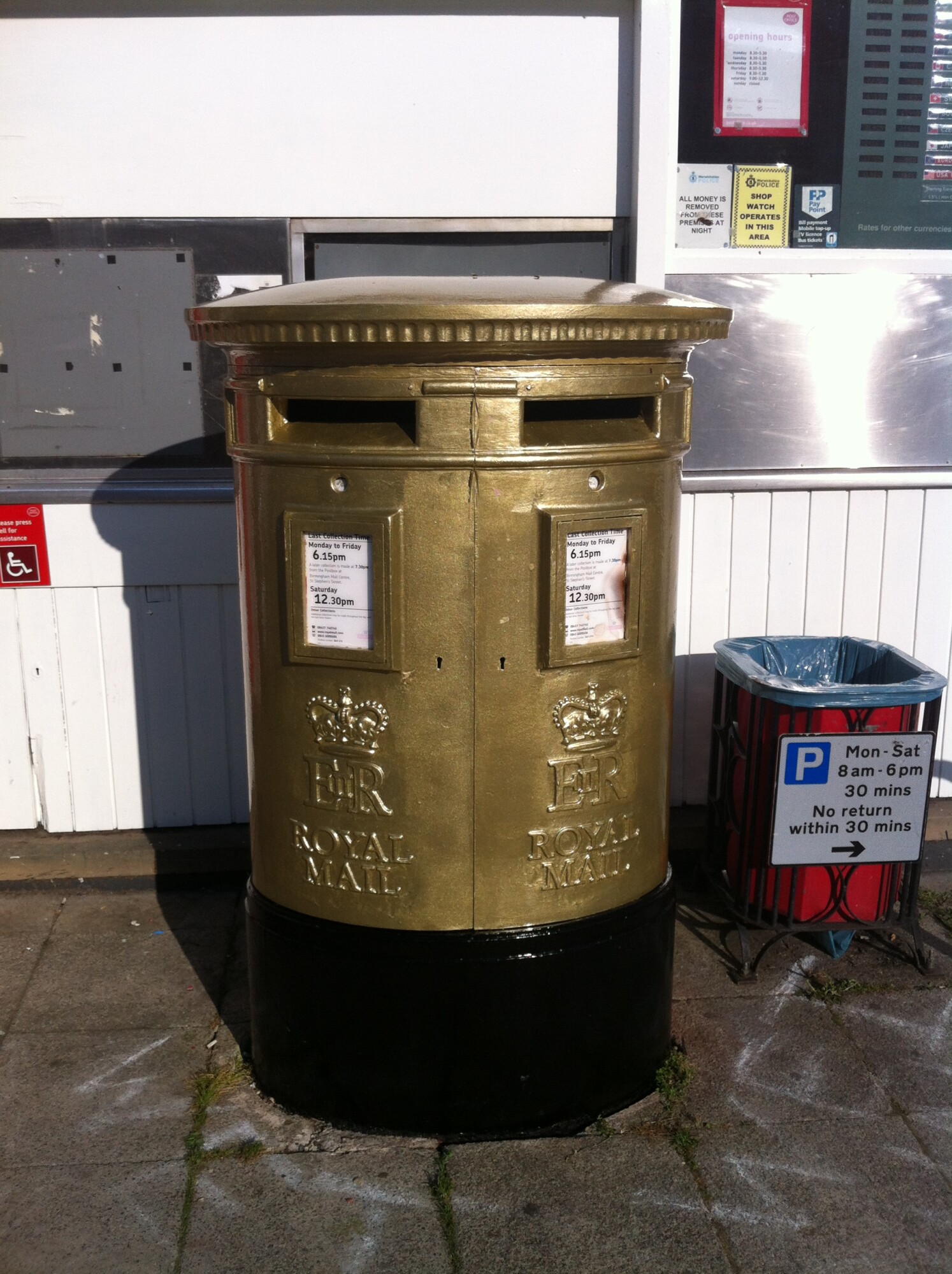
Picture taken on Tuesday the 8th of August 2012
From the summer bunting to the Christmas lights – Alcester always makes an effort with its High Street. Here are a few photo’s I took while walking around the town at night over the Christmas period – unfortunately the conditions were not right for the drone to fly up, maybe next year!


Following on from the earlier footage from Northleach we stopped off at Broadway Tower to take in the winter sunset. Some glorious shots here.


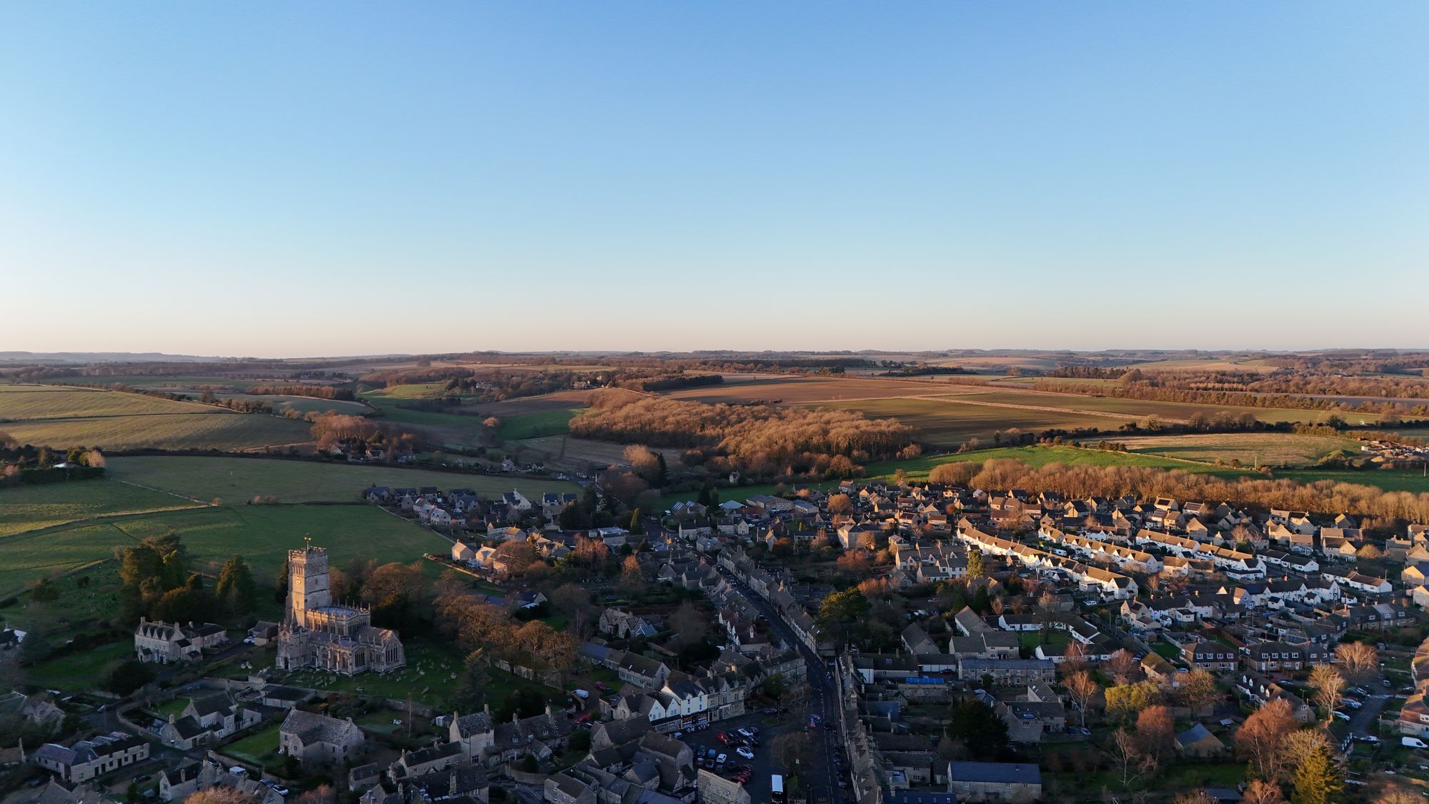
A short visit to the Cotswolds market town of Northleach over the Christmas period. Managed to take the drone up to take some aerial shots of the town. What a day to do it on – glorious winter sun!

The weather was a little drier yesterday so we decided to walk Bredon Hill in Worcestershire.
Parking the car at Elmley Castle (there used to be a castle there) we stopped off at the local pub, the Queen Elizabeth, for a coffee and a mince pie. This is a lovely little place with an old English countryside feel to it. Wood, stone, thick carpet etc – things I like about an English pub. And it’s community owned.
I’m going to have to do this walk properly, with a proper planned route as I just can’t accurately describe where we went! Unfortunately I only captured the walk on my Garmin at the summit so before that my retelling won’t be up to scratch, I’m afraid.
The paths were quite muddy as you’d expect and there were very strong gusts blowing as we were reaching the north side of the hill. The weather did actually turn up there and so we were pelted with hail. Thankfully my new coat was up for the job.
The skies cleared southwards on the horizon once we’d walked past the Parsons Folly.

And now for the embarrassing part.. We didn’t take the turning we should have to do the loop and ended up in Westmancote! The loop had now increased in size and a journey back along the road would be 8.5 miles! And at 3pm this just wasn’t doable. And with no buses on a Sunday we were stuck – enter Uber. Thankfully this service is now operating in the area so we were taken back to the car at Elmley Castle. A small price to pay for a big mistake I say.
A quick debrief in the Queen Elizabeth pub over a tea and what was one of the best homemade sausage rolls I’ve ever eaten. Home. Relief.

Today is the shortest day of the year here in the Northern Hemisphere. Tonight will be the longest night and from tomorrow the day’s will get longer until June when they start fading away, slow, again.
I’ve been meaning to capture a sunrise over the town for a while so I took the opportunity to get up early to do so. The forecast for the actual solstice day itself was overcast so this was the next best thing… Enjoy

